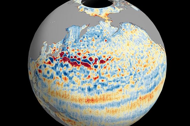
This animation shows global sea level data collected by the Surface Water and Ocean Topography satellite from July 26 to Aug. 16. Red and orange indicate higher-than-average ocean heights, while blue represents lower-than-average heights. Credit: NASA/JPL-Caltech In Brief: Data on sea surface heights around the world from the international Surface Water and Ocean Topography mission yields a mesmerizing view of the planet’s ocean. The Surface Water and Ocean Topography (SWOT), Read More
2025-06-06